It’s All About Terrain
One of the great moments for historians (amateur and, I can only assume, professional alike) is when they visit the landscape of a famous event and say “oh my God, I understand it all now!” For me, Chickamauga and Chattanooga National Military Park is one such place.
 People tend to forget that old battles, battles before mechanized cavalry, helicopters, spy satellites, and unmanned drones, were all about terrain. Old strategies involved taking the high ground, controlling mountain passes, utilizing waterways for transportation and defense, and sneaking to the enemy’s position in the gloom of the morning fog. Entire wars from ancient Thermopylae to Pacific Ocean island hopping in World War II involved strategic uses of terrain to overwhelm and defeat an enemy.
In the American Civil War, Chattanooga was undoubtedly a terrain prize. It was the gateway to the Deep South manufacturing centers in Georgia. The Tennessee River was important to the transportation of goods and men, and acted as a natural defensive barrier against Union incursions. The lowlands around the river, and the natural passes through the Appalachians nearby, made it an easy place for railroad construction. Like the circulatory system of the human body, the Confederacy’s railroads were vital to its survival and its greatest vulnerability for defeat. Chattanooga developed into a great railway crossroad, and was the femoral artery of the Confederacy.

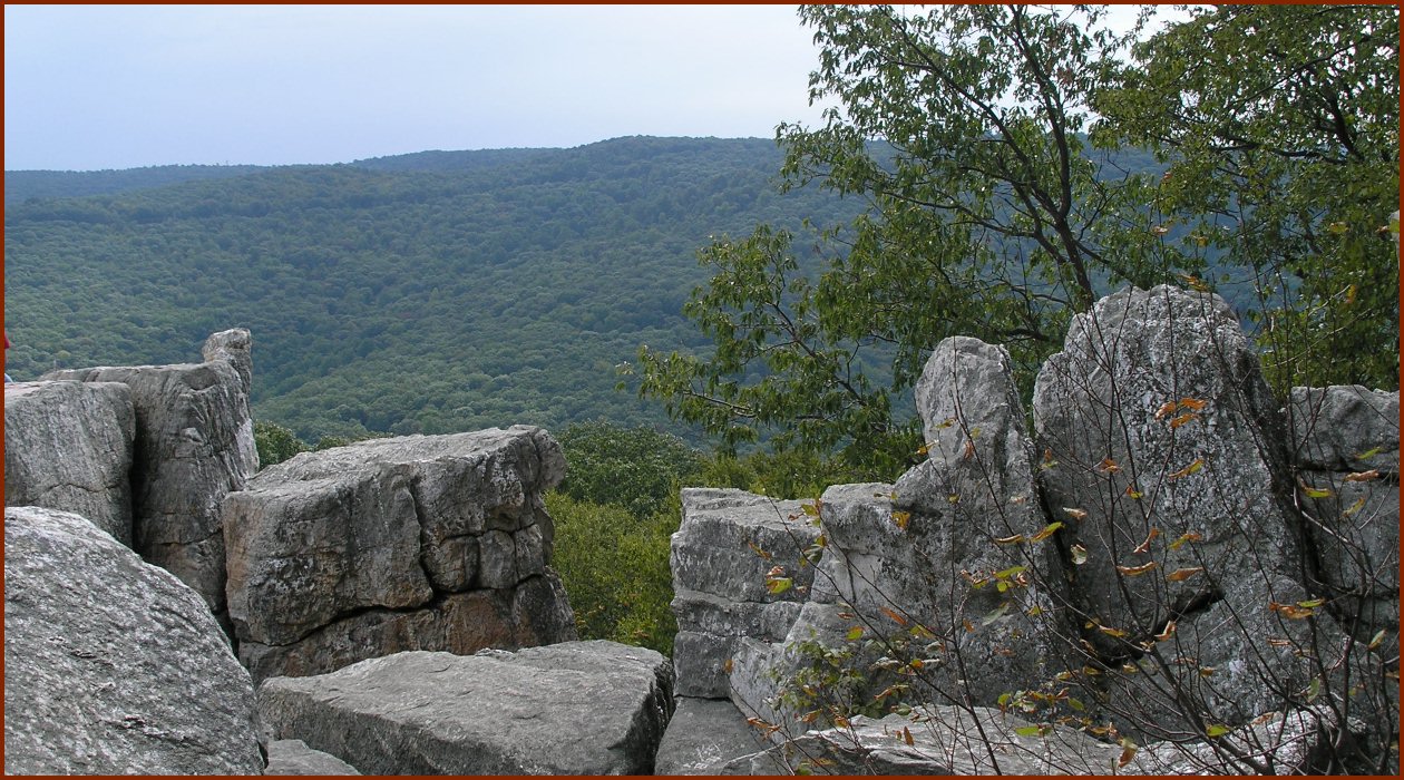
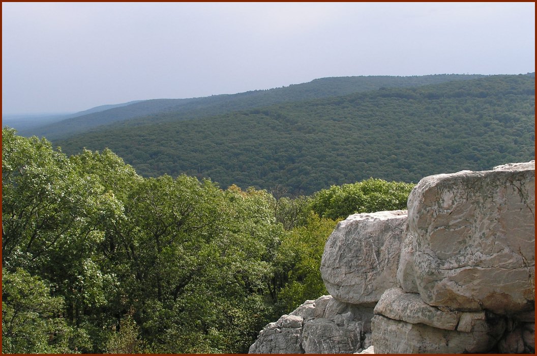
Surrounding this artery were the most famous ridgelines of the Civil War: Missionary Ridge to the east; and Lookout Mountain to the west, overlooking the Tennessee River. If anyone intended to take, and keep, the Chattanooga transportation hub, they needed to take, and keep these ridgelines. High ground is holy ground in armed conflict: gravity becomes your greatest asset. Your enemy needs to climb up to challenge you, an exhausting task by itself. In the days of the Civil War, with heavy rifles and, even worse, cannons and artillery, that task is nearly impossible. So a defender, perched high above, has an unbelievable advantage and an opportunity to rain hot death upon the enemy. Of course, having the high ground automatically makes you a target, and can button you in. Surrounding the base of the mountain traps the defenders, making them ripe for a slow death by siege. The holder of the high ground has increased chances for both life and death.
 I’m not going to recount the entirety of the battles surrounding Chickamauga and Chattanooga, there are resources out there that would do a far better job than I ever could. I will say these battles definitely revolved around the lay of the land, and actually being there brings that “eureka” moment. You can read in a book that Union soldiers raced up the slope of Lookout Mountain to chase out the Confederates, but actually going there, and seeing that side of Lookout Mountain is more of a cliff than a slope, really drives the point home that these soldiers were strong, and tough, and committed, and quite amazing. The feats these men (on both sides of the conflict) are truly mind boggling.
I enjoyed my visit to C&C. The area hasn’t been overdeveloped (although there are tony homes on top of Lookout Mountain – why do the rich, who would have bought their way out of service during the Civil War, now command America’s ridgelines? I sense a master’s thesis in there somewhere…). The ridges, of course, do have some terrific views of the countryside. The Chickamauga Battlefield Visitor’s Center has the best collection of American military rifles I have ever seen (definitely a must-see for gun enthusiasts). And it’s one of the few Civil War sites where an amateur historian can go and say “wow, now I really get it”, just by being there.
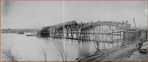
[Sadly, I didn’t own a digital camera when I visited C&C. Public domain historic photos from the National Archives, map from the Library of Congress.]
Links:
Chickamauga & Chattanooga National Military Park
Civil War photographs from the National Archives
Civil War maps from the Library of Congress
Description of the Battle of Chattanooga
Google map to C&C NMP (zoom in & switch to terrain view to get the point)
Read Full Post »